

Give Saguaro West half a winter day and leave room for the weather
Start at Red Hills, choose a scenic drive or a paved trail, and let the Sonoran Desert set the pace.
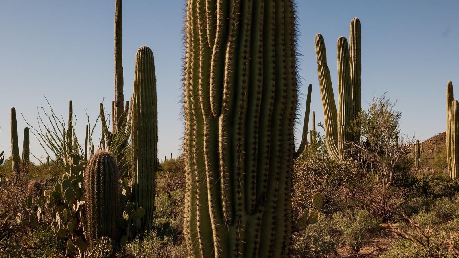
A morning in Saguaro National Park can start with a wall of cactus visible from a parking area. Stop there long enough and the scene starts to separate. A young saguaro looks like a slender column. Its older neighbors have arms arranged at different angles. The hills between them change color in slanting light. The temptation is to treat the first place you can see all of that as a warm-up. On a half-day visit, the first view can be part of what you came for.
Choose Saguaro West, the Tucson Mountain District, for this trip. The national park has two districts on opposite sides of Tucson. The Rincon Mountain District is Saguaro East. A map search that simply says Saguaro National Park can steer you toward the wrong side for your plan, and crossing the city takes time you could spend outside. Put Red Hills Visitor Center on the map and verify the route before you leave.
The National Park Service lists Red Hills at winter-season hours of 9 a.m. to 5 p.m. ordinarily, with a Thanksgiving Day closure on November 26, 2026. The west scenic drive has its own dawn-to-dusk vehicle access. The visitor center closure and vehicle route are separate. Check current alerts for emergency closures or road access on the day. A half day can work even when the building is shut, provided you arrive with what you need and keep the route simple.
Start with the patio and a decision
Red Hills looks out toward the neighboring hills and cactus forest. When it is open, use the staff for the question a map can't answer. How is the unpaved road today? Which short visit suits the group's pace? Is there a closure that makes your planned return route impractical? The NPS says general information and maps are available on the southern patio outside visitor center hours. Download a district map as well, especially if the trip depends on a phone that tends to lose service away from town.
Decide here how to spend the next two or three hours. One option uses the unpaved Bajada Scenic Loop Drive and one or two short stops. Another stays with paved options and gives the terrain more time. The day's weather and the kind of vehicle you have can make the decision for you. That is the benefit of arriving somewhere with two workable ways of spending the morning.
Carry drinking water, snacks and an outer layer. Tucson's winters can be mild, but averages don't describe a particular morning or hillside. The NPS describes cool nights and a winter wet season. Roads or trails can change after rain. A warm start in town need not mean you will be warm on an exposed hillside. Dress so you can add a layer without turning back for the car.
Take the loop if conditions are right
The NPS describes the Bajada Scenic Loop as an unpaved drive of roughly five miles through stands of saguaros. The route begins on Hohokam Road west of Red Hills. Review the official district map before entering and follow posted direction and turn restrictions. Golden Gate Road has a permanent vehicle closure between the Sendero Esperanza trailhead and Picture Rocks Road, so do not count on that segment as a through route. The official site also lists restrictions for oversize vehicles. If you're in a rental or an RV, check conditions and the rental agreement before taking the gravel road.
On the loop, allow enough time for two places instead of trying to stop at each pullout. A viewpoint lets you see how the plants are distributed. A short walk shows what was hard to see from the road, including rocks, soil and smaller plants between the taller saguaros. Check trail and parking conditions and use marked routes. Living plants and desert soil can be damaged by repeated shortcuts from cars, viewpoints and trails. Keep your distance from spines and bring out whatever you bring in.
Allow more time than the mileage suggests. A passenger may want to photograph the hills. Another may need longer to move over an uneven surface. If the first stop takes most of your time, leave the other to a later visit. The main trade-off of a short day is generally between going farther and staying long enough to see what you passed on the way in.
The road is also a reminder to look at the sizes of the older plants without treating each one as a specimen isolated from its surroundings. Check whether younger plants are growing near shelter and notice how much bare ground there is between taller cacti. A photograph from a designated turnout can include some of the hillside around a saguaro. It will remind you where you were and what the neighborhood of plants looked like.
Stay with a paved option if the road is wrong
NPS accessibility guidance lists the Desert Discovery Trail in the west district as a half-mile paved option with interpretive signs, shaded rest points and benches. Check the official description for the surfaces and facilities you need, and verify current conditions in advance. A short route still has exposed stretches, and the way from a parking space to a trail matters to someone using a mobility device. That information is worth discussing before a group arrives with different expectations.
Start with the patio if accessible to you, then spend the longer block of time at the paved trail. The smaller scale works well for reading an interpretive sign or looking at what grows low to the ground. Add a stop in Tucson after the park instead of making up time on a road the ranger advised against.
The same backup works when there has been enough rain to make an unpaved drive a poor choice. The park's current conditions page carries district-specific updates. Look under Tucson Mountain District, and also look at the broader alerts. If a warning or closure affects the route, save the loop for another day. A light shower, wind and a road already softened by earlier rain are separate planning questions.
The benches give you a way to make a short outing work for different people. On a bright morning, agree to spend the first few minutes reading one exhibit or looking from a resting point together. Then decide who wants to continue and where to regroup. The visitor center can advise on available accessible guides and the latest trail conditions. If you are making the trip specifically for the paved surface or a place to rest, check access before driving out. The same route can feel like a different visit when people have time to stop instead of trying to match the strongest walker in the group.
Use lunch to set a turnaround time
A half day is easier to keep when departure has a time. Choose it before the first longer stop. Someone meeting friends for lunch in Tucson might plan to leave the visitor center area by late morning. A group arriving after lunch might use the onset of dusk and the vehicle access limits to set an earlier turnaround. Check local daylight for your date and allow for the time it takes to return from the farthest point, not just the time listed for the drive out.
Bring your own water and a simple snack. NPS lists water on the Red Hills visitor center patio and restrooms outside the center, but check facility notices before relying on them on a holiday. Keep a meal stop in Tucson as its own part of the outing, where you can choose the location based on the direction you are heading next.
For families, choose a recognizable meeting point if the group wants to look at different things. If a child wants to spend time on a short trail, the rest of the itinerary can shrink. If a companion would rather stay at the patio, plan a short loop from there or arrange the timing so they have shade, water and company. A longer list of things to do can make a short trip feel like a sequence of departures. One or two deliberate stops gives people time to look.
What to check before leaving Tucson
Open the park map and confirm it says west or Tucson Mountain District. Check the park's hours, alerts and road restrictions. Have the right fee or pass information from the park, and decide whether the scenic loop is appropriate for your vehicle. Look at weather for the district, put a layer and water within reach and set an approximate time to leave. If your visit falls on Thanksgiving, plan for the published visitor center closure.
Take a minute to tell someone which district you chose and when you expect to be back if you will go beyond the area with reliable service. For a day when the park is a stop between other plans, set the destination for the drive afterward before turning off from the city. Having the next address and a saved map will make it easier to leave when you intended, even if service drops.
The airport, town and national park can sit surprisingly close on an itinerary and still ask different things of your time. A half day at Saguaro West makes more sense when the plan is a starting point, a short choice and room to change it. If the cactus at the first turnout holds your attention, the trip is already underway.