

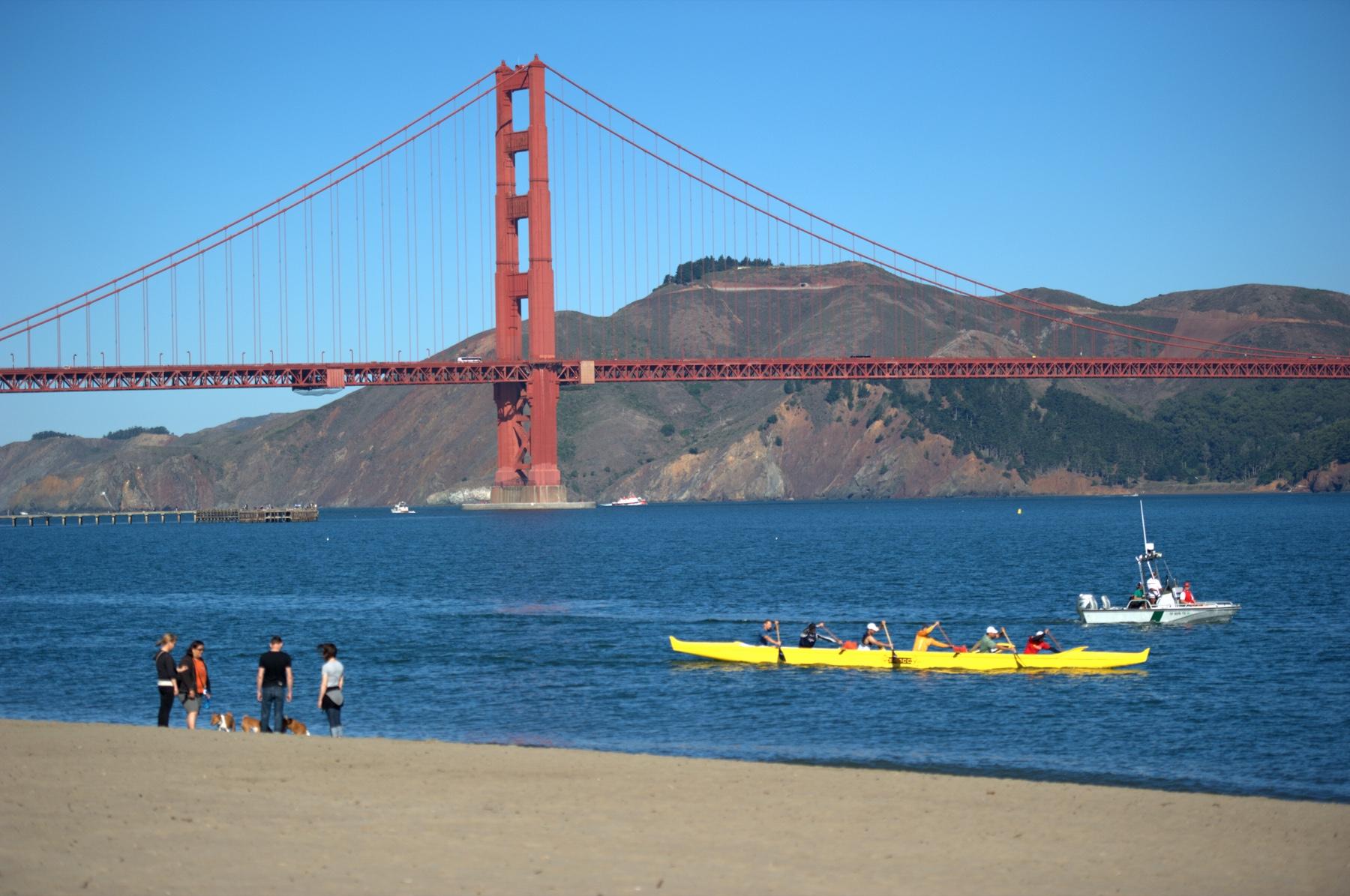
Walk San Francisco’s Crissy Field with the winter light on your side
Use the Presidio as your starting point and choose how far to follow the bay before the wind or light tells you to head back.
San Francisco has enough hills to make the phrase “short walk” worth questioning. At Crissy Field, the waterfront is a welcome change. A hard-packed promenade follows the bay, and the Golden Gate Bridge moves from backdrop to an increasingly large part of the view. You can make a credible afternoon out of a single section without crossing the bridge, setting off on a strenuous trail or committing to a long route on a day when the weather has other plans.
Begin at the Presidio Transit Center and Tunnel Tops if you want a place to get oriented above the water. Arrive at the Crissy Field end nearer East Beach if keeping the walk nearly level is more important. The two starts lead toward many of the same sights, but they ask different things of the group at the end. An easy slope on the way down can be a significant part of the return for someone who is tired, moving with a stroller or using a mobility device.
The walk here is an out-and-back with choices. Start with the marsh or the bay. Continue toward West Bluff if you have time and the conditions are comfortable. Consider Fort Point separately if you want to go inside and its hours line up. Reserve enough daylight and energy for the way back. A trip that starts with a turn-around decision lets you enjoy a short winter day without treating rain as an itinerary emergency.
Decide whether to start high or low
Tunnel Tops links the Main Post area with the waterfront over the road tunnels. The Presidio gives 210 Lincoln Boulevard as its address and lists the 43 Masonic as serving the Presidio Transit Center. The Presidio GO Downtown Route can also take riders to the center from downtown stops, with restrictions on certain weekday commute trips. Check the current service schedule for your day, especially during a holiday week. If your party is taking transit from more than one neighborhood, the transit center is a useful place to meet before heading down together.
To start lower, look up Muni's 30 Stockton service to the Crissy Field area and the appropriate stop for your direction. The Presidio lists Crissy Field Center near Mason Street and Halleck Street. If you drive, consult current parking maps, hours, payment signs and any lot restrictions. Pulling up a transit or parking choice ahead of time does more for this plan than deciding exactly which point you will photograph.
Starting high gives you a view that helps make sense of the geography. Starting low can save your legs or make it easier to bring someone along. Both are legitimate plans for seeing the shore. The decision for a short trip is how much of the day you want to spend getting to and from the way you entered. For a family that will split up and regroup, choose a landmark on the level you are using. A meeting point somewhere “by the visitor center” can put people on different levels looking for one another.
SFMTA lists a long and a short version of the 30 Stockton. Look for a trip that actually serves the Presidio, and check the timetable rather than assuming every bus with that number goes as far as the waterfront. Mason Street and Yacht Road is one listed East Beach stop. Save the stop for the return direction as well. The useful place to check a live arrival is while you are still near a sheltered place to wait, especially if your walk is ending after the wind has picked up.
Pause where the marsh meets the bay route
The National Park Service describes Crissy Field's waterfront route as flat and hard-packed. Listen for the different kinds of activity on it. Some people are on the way to a regular run or bike ride. Others are deciding where they can see beyond the low vegetation and into the tidal marsh. If your group wants to stop and look, move to one side before bringing everyone to a halt. The shared path remains a route for people going somewhere.
The restored marsh near East Beach adds a second subject to a bridge walk. The Presidio notes that the marsh serves birds using the Pacific Flyway. The available view changes with water and weather, and the birds have their own schedule. You can look from the public path and signs without crossing into a sensitive area. Someone who came for the bridge may be the first to notice how much is happening a few feet from the walking route.
There is a longer history here. NPS describes the presence of Ohlone people before the site's military era, and the Presidio traces the present marsh to shoreline restoration after the area had been used as an Army airfield and industrial space. A short stop at an interpretive sign can connect those very different uses of the land. The landscape people see today took decisions about what to save and what to bring back. It is worth more than the time needed to raise a phone over a fence.
Make West Bluff an option
Follow the Golden Gate Promenade west if the shore still feels good to walk. The bridge takes up more of the frame as you go. West Bluff has a picnic area and is near the Warming Hut, Torpedo Wharf and Fort Point. NPS lists accessible restrooms at East Beach, the Golden Gate Bridge Plaza and the Warming Hut. Check individual facility hours and current access before counting any indoor stop as part of the trip.
The shoreline is more exposed than some city streets. An extra layer, something to protect against wind and a bag you can close come in handy. A bench that looks inviting while you are moving may feel quite different if you stop in the wind. If the group wants a picnic, pick a time and place with the forecast in mind, or plan for a short snack and a meal somewhere warmer afterward.
If you want to visit Fort Point, check the historic site's hours and alerts yourself. A promenade is one kind of public access. An operating historic site is another. Keep the exterior view and the interior visit as separate parts of the plan. By doing that, you can reach the end of the section you chose and feel that you arrived even if the fort is shut. If a short stretch of shoreline has been closed temporarily, read the signs rather than treating the edge of the bay as a route around the closure.
Plan the return before the best view
A short winter day can vanish during the slowest part of the walk. Look up sunset and the weather for the exact date, and plan to turn around comfortably before darkness if that's what your group needs. Count the time you have been walking from where you started, including all the stops. Leaving thirty minutes of buffer does more good than remembering after you have passed the spot where everyone could have turned around.
For an accessible visit, talk about the whole journey. NPS calls the promenade hard-packed rather than promising the same experience as a smooth indoor floor. Wet or uneven areas and the routes to some amenities may matter. The Presidio publishes accessibility information and a visitor map. Use them to choose a start that suits the person with the most specific needs. If the grade back to Tunnel Tops is a concern, start at the low end or see if transit and parking let you organize a different return.
Bay conditions can be cold and changeable. For this walk, the path has all the access you need. Check posted signs near the beach, respect closures and watch footing where surfaces are wet. If the weather limits the view, a shorter walk around the marsh or a Main Post visit may be a better use of the time than waiting at West Bluff for the bridge to emerge.
Build an afternoon around two decisions
For a first visit, meet at the transit center and walk down through Tunnel Tops only if the grade works for everyone. Spend the first waterfront stop around the marsh and the East Beach end. Decide there if you want just the near section or an out-and-back that reaches West Bluff. Keep a return time and the exact transit stop handy. For a repeat visit, start on the lower route and give yourself time to read signs or stop for food instead of repeating every waypoint.
On a day with heavy showers or a stiff wind, switch the order or shorten the walk while you are still close to the starting point. The bridge and the bay are still there on a future visit. If you have two hours of usable weather and the day ends early, a plan that works in ninety minutes can feel generous. If you are carrying binoculars or a camera, pack for the possibility of rain and use a strap or case that still leaves a hand free for the return.
Crissy Field's practical advantage is the obvious one. You can see what direction you are heading and then turn around when you like. Use that freedom. Some afternoons will belong to a long look at the bridge. Others will belong to the birds at the marsh and enough time to catch an ordinary bus back into town.
Sources
- National Park Service Crissy Field location and history
- National Park Service West Bluff Beach and promenade
- National Park Service Fort Point hours
- Presidio Tunnel Tops visitor information
- Presidio Crissy Marsh location and access
- SFMTA 30 Stockton route and stops
- Presidio transit options
- Presidio accessibility
More from Fever: Fever Lifestyle
Lead photograph: Guillaume Paumier / Wikimedia Commons, CC BY-SA 3.0. Archival image resized for web; display crop may vary.
